How to use Compass
Compass is a Geographical Information System (GIS) web service which allows users to view a variety of maps and geographical information in a user-friendly way. In principle, any combination of map and data layers can be viewed together and interpreted.
Navigation

You can pan and zoom the map using the tool on the left-hand side of the map, or the toolbar along the top provides a number of ways to navigate and interact with the maps:
- A: Scale – a drop-down list to change the scale of the map
- B: Information – with this tool selected, clicking on a map feature may bring up additional information
- C: Pan – with this tool selected, click and drag on the map to move the view around (you may also be able to zoom in and out using your mouse wheel with pan selected)
- D & E: Zoom in and out- with this tool selected, click on the map to zoom in or out on a point, or draw a box around an area to quickly set the zoom
- F: Co-ordinates – jump to a location by entering co-ordinates
- G & H: Back and Forward – skip back or forward to a previous view
- J: Measure line – use to measure a linear distance – keep clicking to add further sections to a path, double click to finish. The distance will be displayed on the information bar at the bottom of the map
- K: Measure area – use to measure area – keep clicking to add further corners to create the shape, double click to finish. The area will be displayed on the information bar at the bottom of the map
- L: Print – creates a printable PDF of the current view. This function will be disabled if a copyrighted map is selected. Choose ‘Open Street map’ or ‘None’ as the base layer to enable printing (see below for details on setting layers)
- M: Favourite – create a bookmark of the current view to use later
- N: Help – not currently available
- O: Copyright – information on copyright for the layers available on Compass
- P: Search – allows searching for a particular location in a variety of ways
Layers
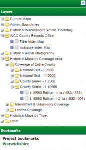
Compass organises the available information into different layers, and these can all be switched on and off to provide different combinations of information. Click here for details of some of the available layers.
- Each type of layer has a folder structure which can be opened and closed by clicking on the plus (+) or minus (-)
- The first set (labelled ‘Current Maps’) are modern maps designed to act as base maps to help navigate Warwickshire and provide context to the other layers. Only one base map can be selected at a time.
- The remaining layers can all be switched on and off independently, so you can view as many of these as you need to at a time. Click in the box next to the name of each layer to tick or un-tick it.
- You can click and drag any of the layers in the list to move them up and down. This will change the order in which they are displayed on the map, so you can place one on top of the other. Apart from the base layers which always the lowest layer on the map, Compass will display the layers at the top of the list on top of all the other layers.
- You can also change the opacity of any of the layers, to allow you to look through one layer to the layer below. Right-click on any of the layers, select ‘Change Layer opacity’ and drag the slider to adjust the opacity.
- You can minimise the layer panel to see more of the map by clicking the double arrow at the top of the panel. Click this button again to reopen the panel
Information bar

Information about the map can be found at the bottom of the screen:
- Scale
- Copyright
- Projection type
- X and Y coordinates of the cursor position


Warwickshire County Records Office
Opening hours: Wednesday to Friday 9am to 4pm, Saturday 9am to 12 noon.